
Welcome to Seth's Weather
Daily Colorado weather forecasts and consulting
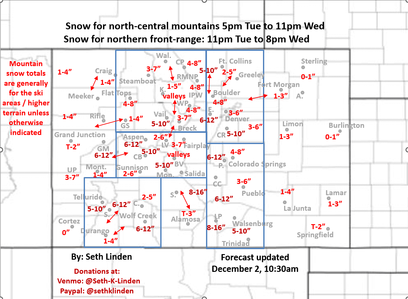
Updated snowfall map for the approaching storm system, valid through 8pm Wed
Dec 2, 2025, 1:39 PM
2/02/25 11am: Alright, I was able to look at all the latest 12z (5am init) model data and I updated my snowfall forecast map, valid from now through 8pm Wed (this does include a little bit of snow that has fallen in the mountains this morning).
Forecast remains on track with just a few small changes. I actually increased snowfall amounts for much of the front-range as models show a solid northeasterly upslope event, especially tomorrow morning. Biggest impacts will be from 12am-6pm tomorrow, heaviest snow still expected from Boulder south to the Palmer Divide.
Generally 3-6" for Denver, 4-8" for Boulder/Golden and the western suburbs with 5-12" for the foothills and PD, heaviest amounts from Boulder county south.
As I mentioned this morning: Maybe a bit less snow for parts of northwest CO, the heart of Summit and Grand counties since models show east to west upslope flow at the surface and mid-levels so not as favorable wind direction (3-7" for those ski areas), but good amounts west of Vail Pass and southwest towards Aspen.
The Front Range mountains east of the Cont. Divide should do well: 4-8" in spots (heavier east with this one)
Second half of the event from 11am Wed to 5am Thu will favor southern CO with heavy snow.
I increased snowfall for Colorado Springs (4-8"), and Pueblo to Trinidad: 3-6" and likely heavy snow for the Sangre De Cristo and Wet Mountains (8-16" fo those areas, above 9k ft).
San Juans and Elks should also do well with 6-12" in many areas, refer to map.
The storm clears out by early Thu am.
More snow in the forecast for the mountains from Fri to Sun, two back to back waves again (snow train getting going now), favoring north-central CO. I'll have more on that later.
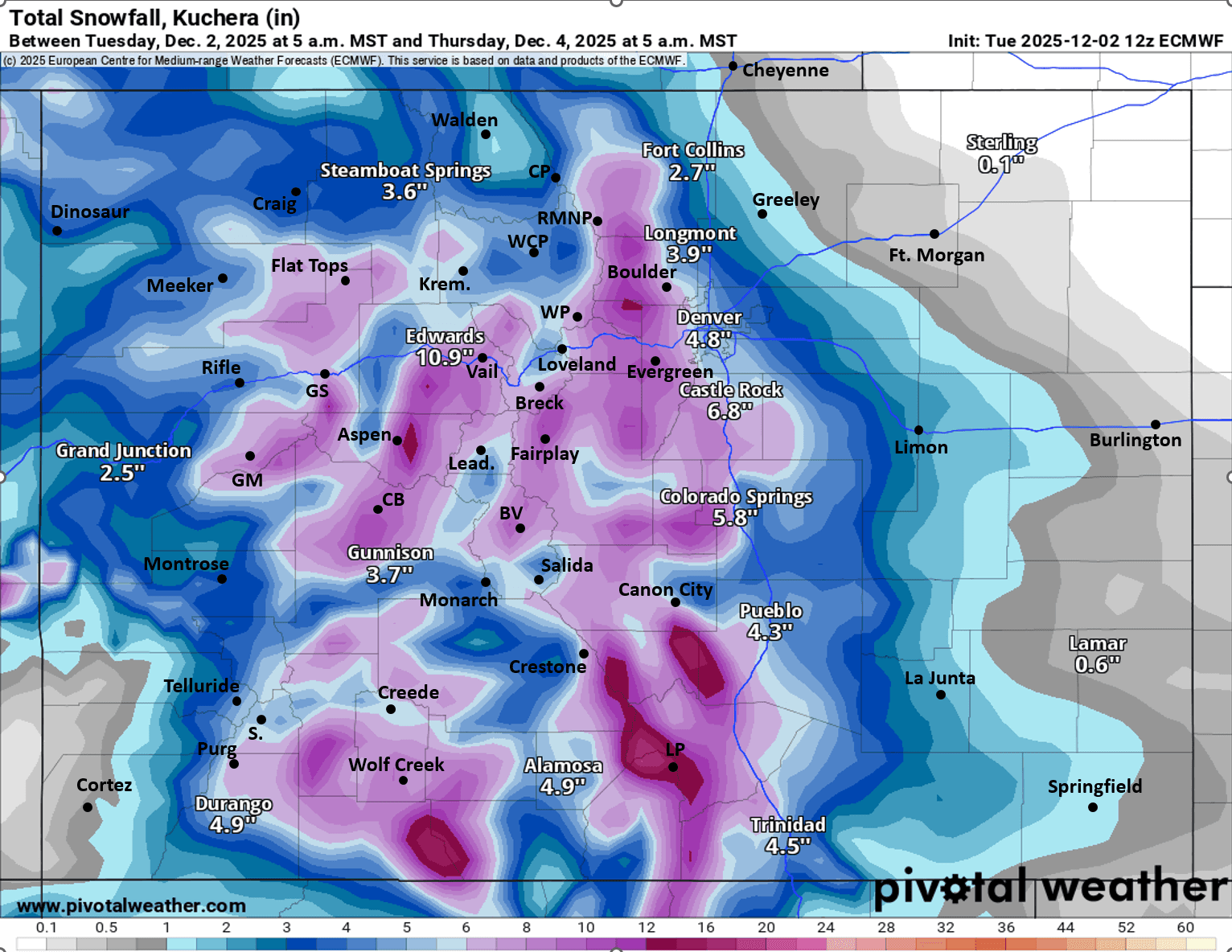
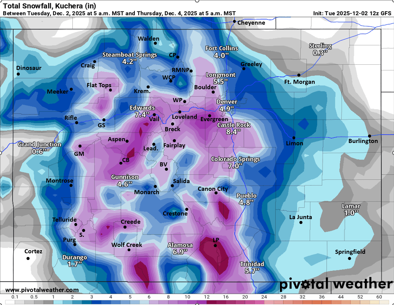
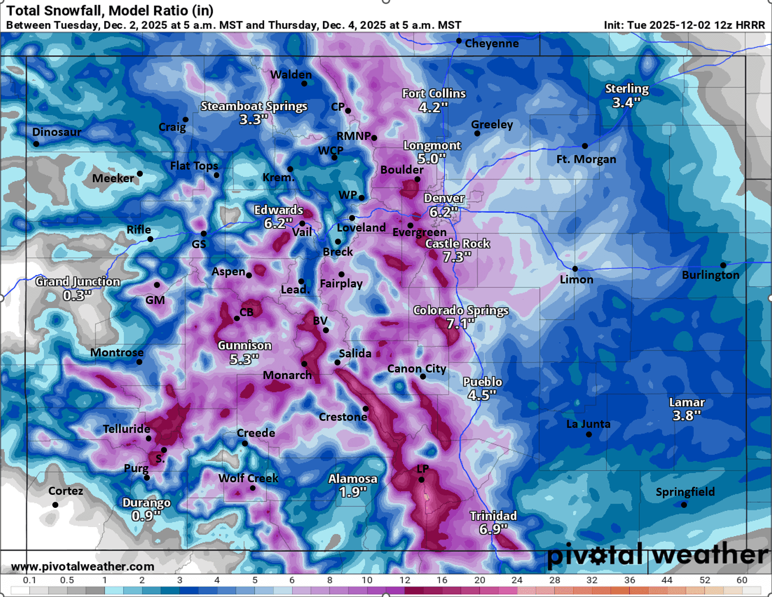
First image is my final snowfall forecast map through 8pm Wed. Images 2-4 compare forecast total snowfall from now through 5am Thu from latest ECMWF, GFS and HRRR models (take modeled amounts with grain of salt but you get the idea).
Seth Linden combines professional expertise with a lifelong passion for weather forecasting.
A Colorado native and avid skier, Seth turned his early fascination with weather into a career, earning degrees in Physics and Atmospheric Science from CU Boulder. For over 25 years, he has worked at the National Center for Atmospheric Research (NCAR), where he develops winter weather decision support systems for Denver International Airport and state transportation departments.
He shares his forecasting expertise through the Seth's Weather Report Facebook group, specializing in winter storm predictions.


Like what you read?
Receive daily weather reports straight to your inbox with Seth's Daily Newsletter. Sign up below.